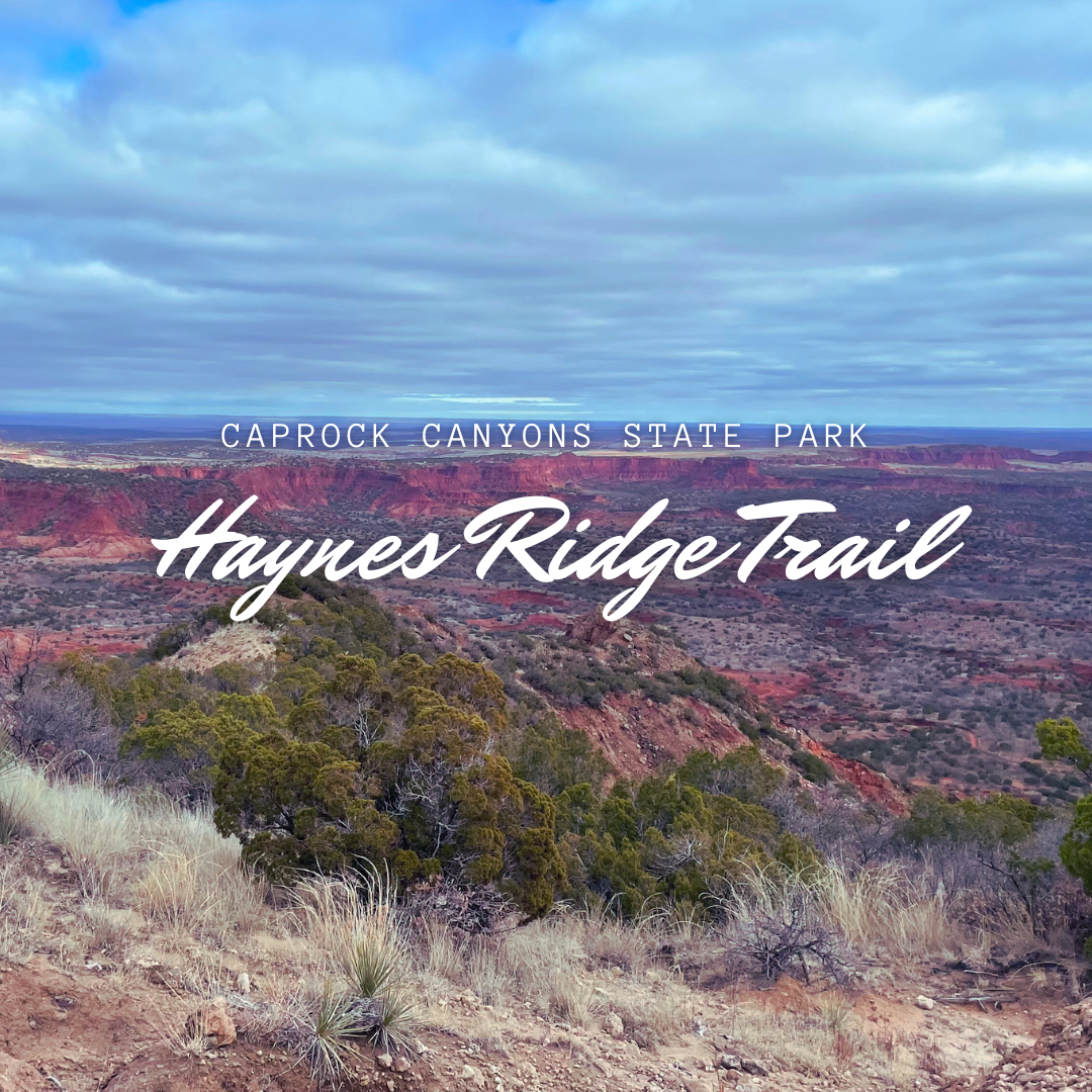
The Haynes Ridge Trail is a popular hiking route in Caprock Canyons State Park in Texas. This trail is known for offering stunning panoramic views of the rugged landscape that characterizes the park. It is approximately 6.4 miles round trip when done in combination with the North, Upper North, and Upper South Prong Trails. It’s considered a moderately strenuous hike due to its elevation changes and rocky terrain.
The Beginning is the Toughest Part
Parking is available at the North Prong Trailhead. HERE is a map view to help you out. Parking isn’t the tough part though. It’s after you get out of the car and get onto the trail. You’ll first start out on the North Prong Spur Trail and travel about 0.5 miles until you see the sign for the Haynes Ridge Trail to the left. Now you’ve made it to the hard part. At first glance, it doesn’t really seem like there’s much of a trail at all.
Then, you realize it’s up, up, up to the top. The trail is very narrow and rocky, but it’s there. I would strongly encourage you to take as much time as you’d like getting up to the top. Take plenty of breaks and drink water. Thankfully, the beginning of the Haynes Ridge Trail is less than 0.5 miles to the top so you totally got this. Once at the top, the views are worth it.
To the Fern Cave
After you’ve taken in all the views, continue down the trail for about 2 miles and then take a right on Upper South Prong Trail. Follow the arrows and sign to the Fern Cave. The cave is home to various species of plants and animals adapted to its unique environment. Ferns and other vegetation thrive in the moist microclimate of the cave, adding to its charm and biodiversity. While exploring the cave, be cautious of slippery surfaces and uneven ground. It’s always a good idea to bring a flashlight or headlamp if you plan to venture into darker sections. Unfortunately, we were not at this park at the best time for cave viewing as the ferns were not as green as they typically are.
"The Last Dance"
The Upper South and Upper North Prong Trails meet at the cave so to continue on take the Upper North Trail. Along this 2 mile trail is where you’ll get unique views of the landscape, including a hoodoo. “The Last Dance” is one of the notable formations in the park. Hoodoos are tall, thin spires of rock that protrude from the bottom of an arid basin or badland. Look for this hoodoo about halfway along the trail.
Take a right on the North Prong Trail for a little over a mile hike back to the parking lot. Taking the opportunity to make a loop out of these trails affords you the quintessential experience to immerse yourself in the rugged beauty of Caprock Canyons State Park. With its challenging terrain, breathtaking views, and opportunities for wildlife sightings, it offers a rewarding adventure that’s well worth the effort.
Consider the Wonders is a travel blog intended for entertainment purposes only. We are not RV, travel, or hiking experts and are not making recommendations.These are our opinions and you should do your own research and make your own decisions.
Consider the Wonders is not affiliated with Caprock Canyons State Park or Texas State Parks.


Comments are closed