Fort Bowie was the site of violence between the Chiricahua Apache and the US Army for more than 20 years. As the United States expanded westward and into the land where the Apache had lived for years, battles and disputes arose along with many lives lost. A more in depth view of that history can be found HERE
Getting to the Fort
No matter what direction you come from, an unpaved road is the only way to get to this national historic site and its trailhead. How long you want to be on that road is all up to you. If you’re coming from Interstate 10, the last mile of your drive is on the unpaved Apache Pass Road. If you’re coming from the south or Chiricahua National Monument, you’ll have 8 miles on unpaved Apache Pass Road. Don’t worry too much about the road being unpaved. It’s a very well made road, but if it has rained recently, there may be potential flooding on the road so a call to the visitor center to check for road conditions would be advisable.
There is an alternative to travel by car directly to the fort. You can find the accessibility information HERE
A Hike full of History
So much of Fort Bowie rests in all the things that surround it. The original road to the fort was for wagon use and now visitors are able to hike from the Trailhead at Apache Pass Road 1.5 miles on this same road and catch a view of the past. Check out the PARK MAP for more details.
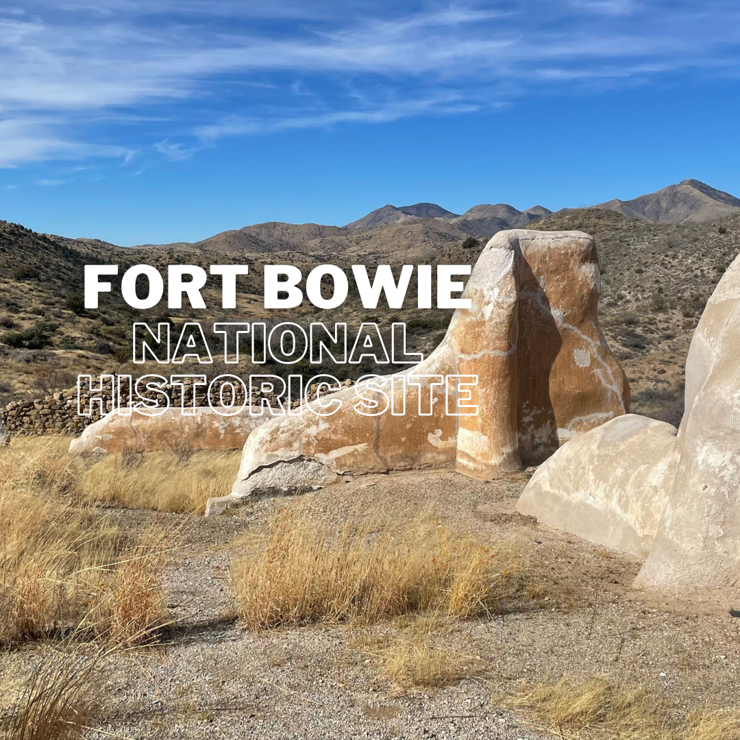
Butterfield Stage Station
Built in July of 1858, passengers riding the state coach stopped here for food and rest. Soldiers sought refuge here at one time and there was even a mail route.
Post Cemetery
The fort cemetery was the resting place of many soldiers and others that lived in the area during the time this land was being disputed. The remains of 72 soldiers have been moved to a National Cemetery, but 23 civilian graves remain. Most noteworthy is Apache Chief, Geronimo’s son, Little Robe.
Chiricahua Apache Indian Agency
The ruins of a building where U.S. Indian Agent, Thomas Jeffords, governed the 900 Chiricahua Apaches.
Apache Camp
An idea of what Apache camp life was like.
Apache Spring
An all important spring that was a much needed water source for the area.
First Fort Bowie
The ruins of the first Fort Bowie which were built in 1862 are a short 1/8 of a mile off the trail and worth checking out. There are some great views.
Second Fort Bowie
The second Fort Bowie was built 2 years after the peace agreement with the Apache chief, Cochise. However, when he died, Geronimo and others began raids in the area and the fort became the hub for military operations in defense of the raids.
Visitor Center Last???
I never thought I would say this, but you will end up going to the visitor center last on your visit to this fort. The trail takes you to all of these historic locations as you make your way to the visitor center. It is located next to the second Fort Bowie, so if you want to go inside first, that is a good option. When you’re ready to head out, you can take the Overlook Ridge trail just past the visitor center to make your way back to the trail or go back to the way you came.
Consider the Wonders is a travel blog intended for entertainment purposes only. We are not RV, travel, or hiking experts and are not making recommendations.These are our opinions and you should do your own research and make your own decisions.
Consider the Wonders is not affiliated with Fort Bowie National Historic Site or the National Park Service.


Comments are closed